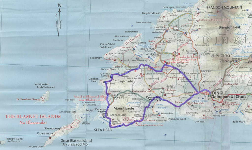
The Slea Head loop is primarily just biking on R559 out of town until it takes you back around the end of the peninsula to where you started.
We did the loop clockwise, with the southern shore first. Instead of taking the regional road out of town though, where it's kind of busy, we took Main St, which becomes Goat St, which becomes Ashmount Ter, all of which takes 1.5 km, then you're back on R559. Stay left when the two branches split. At one point you can take a left to stay closer along the coast on a local road, which then joins back up. If you're passing de Mordha B&B on R559, you've missed that turn and should just keep going. About ¾ of the way around the loop, R559 turns away from the water for the last time before going straight south back to town; at that point, you could stay left instead, first on Cois Farraige and then right at the first real road, left when that road ends, and left again at the end--which would expand the route and the coast time, eventually meeting up with R459, which also goes straight back into Dingle. The route we took is 43 km. The addition with R459 would add 7 km extra.
Dingle Peninsula, Co Kerry, Ireland
-- 7/12/2014


